|
previous topic :: next topic |
| Author |
Message |
LapDog
Since 19 Dec 2008
66 Posts
White Salmon
|
 Sun Jul 13, 14 4:19 pm Post cool kite session GPS tracks here Sun Jul 13, 14 4:19 pm Post cool kite session GPS tracks here |
 |
|
Here's a link to the GPS track of a recent lap from Underwood to Viento and back:

and a couple of laps to Swell City and back (also from Underwood)

I'm interested in finding the conditions for max upwind speed and max upwind angle. Any ideas out there? Perhaps from experienced racers?
Last edited by LapDog on Tue Aug 05, 14 7:59 am; edited 8 times in total |
|
|
dwaynej

Since 09 Sep 2013
207 Posts
Stoked
CGKA Member
|
| Sun Jul 13, 14 5:13 pm |
|
|
I have been tracking my kiteboarding trips for some time now. Very hard to perform the analysis on the water without instruments designed for the task since conditions are variable and changing. Garmin has a nice sailing watch which may be suited to the task you are looking for... http://www.sailingworld.com/gear/garmin-quatix
From a sailing perspective Velocity Made Good (VMG) reflects an optimal tack angle and speed they will get you to your upwind destination so highest tack and slowest boat speed are not optimal... Without instrumentation, its close to impossible to know optimal tack angle/board speed for variable conditions.

Dwayne
|
|
|
lekaks
Since 02 Apr 2008
151 Posts
Hood River, OR
Stoked
|
| Sun Jul 13, 14 7:29 pm |
|
|
| That's cool...
|
|
|
LapDog
Since 19 Dec 2008
66 Posts
White Salmon
|
| Mon Jul 28, 14 9:19 am |
|
|
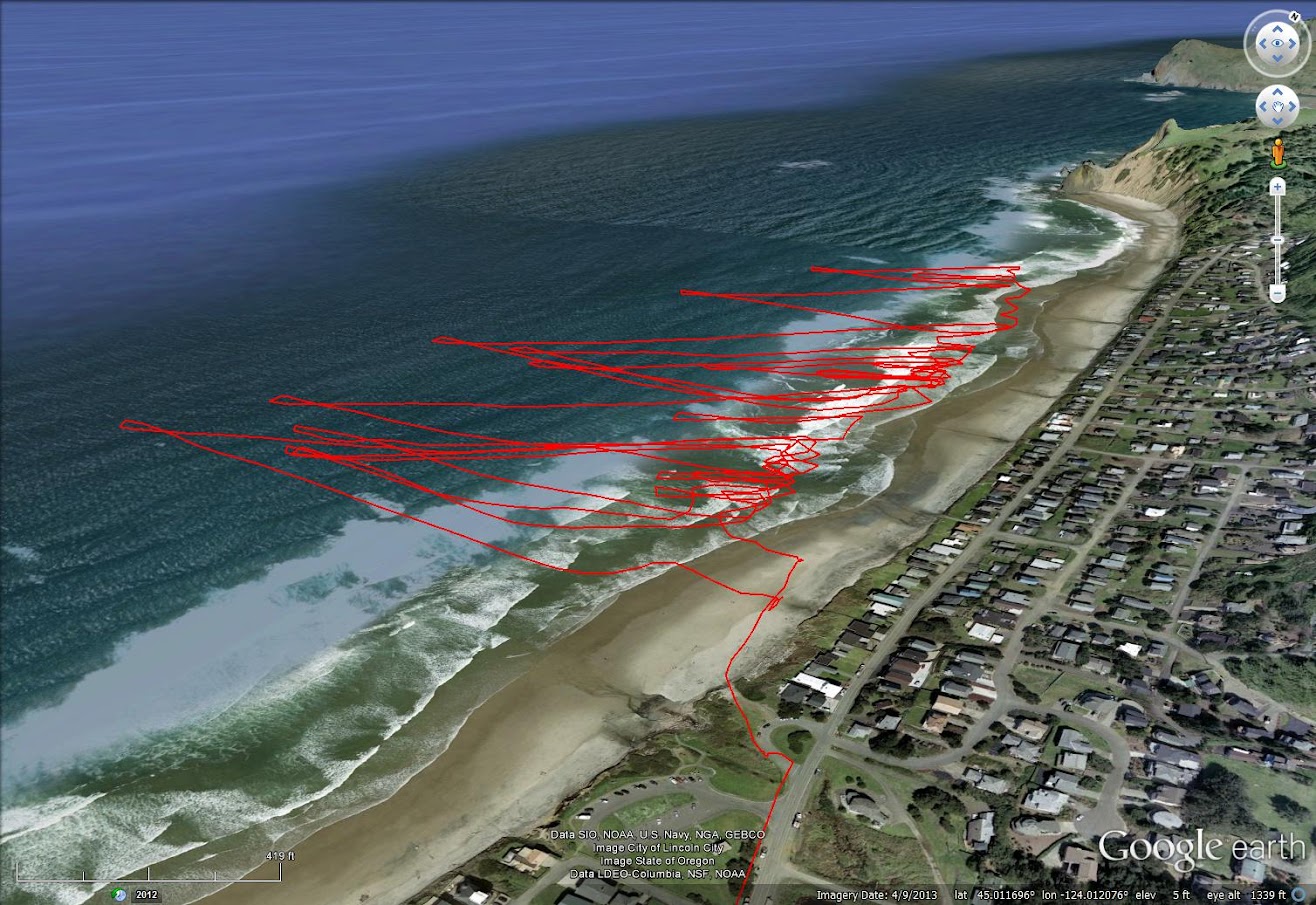
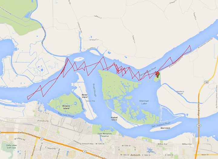
A neat GPS track of a downwinder from an Ocean Beach to Washburn state park on 7/25/2014

and one from the next day at Road's End, Lincoln City, OR
_________________
- matt wheeler |
|
|
LapDog
Since 19 Dec 2008
66 Posts
White Salmon
|
| Tue Aug 05, 14 7:55 am |
|
|
Here's one from Manzanita last Sunday 8/3/2014 ...
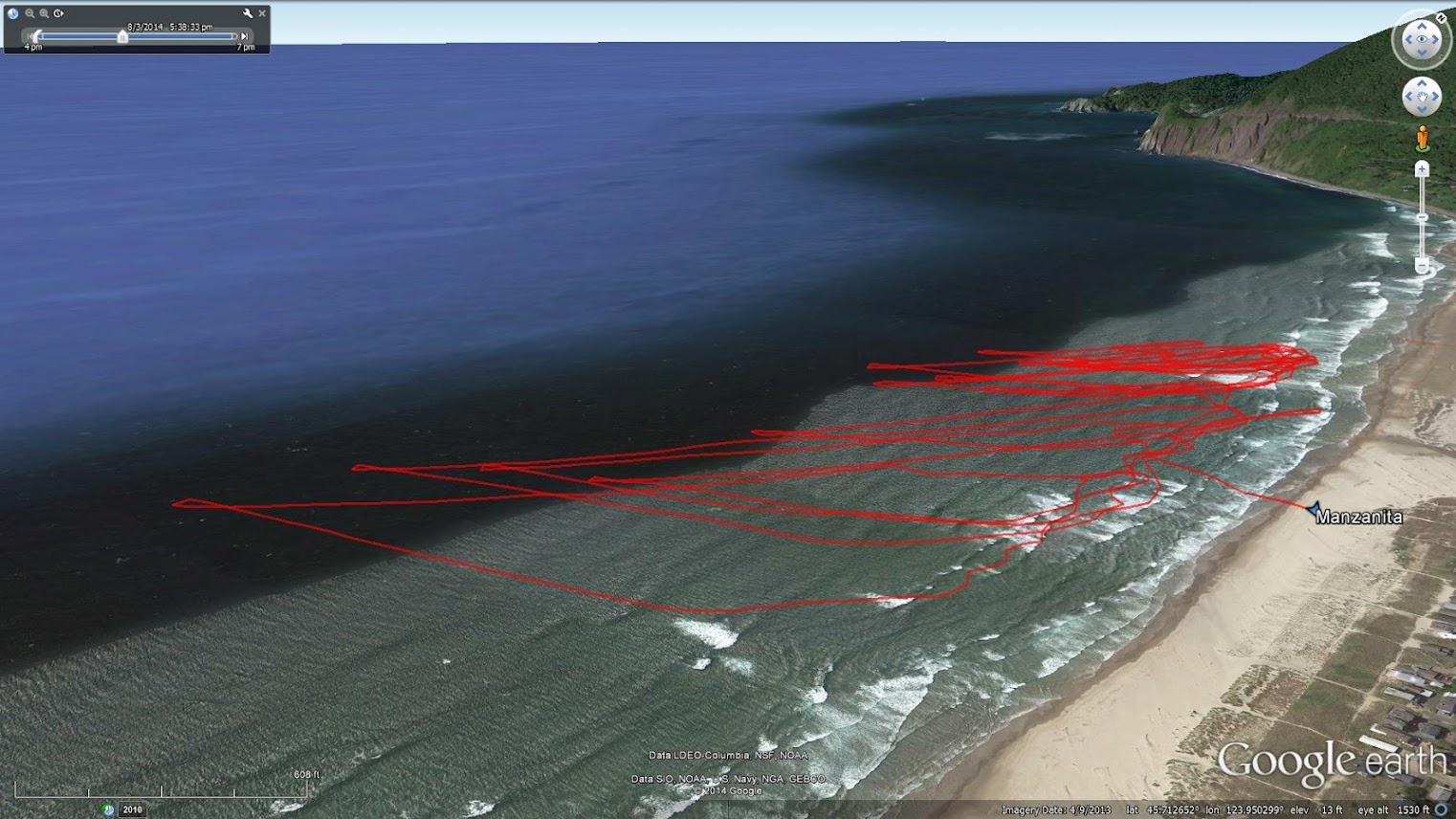
Is anyone digging these session track images? I like looking at the wind, wave, shoreline, and headland orientation.
_________________
- matt wheeler |
|
|
ShiverMeTimbers

Since 26 Feb 2013
381 Posts
Gig Harbor
Obsessed
|
| Tue Aug 05, 14 8:07 am |
|
|
| this is great! what are you all using to track this stuff? your phone in a dry bag? GPS unit?
|
|
|
LapDog
Since 19 Dec 2008
66 Posts
White Salmon
|
| Tue Aug 05, 14 8:24 am |
|
|
I use a Garmin Forerunner 10 GPS watch. Fred Meyer sells them for $129. But an iPhone in a dry bag could do the same thing. MotionX has a nice track recording app for iPhone. Could also get this data from a GoPro, if it were left on for the whole sesh.
Once you get the data file off the GPS device, just drag it onto Google earth. I usually trim the extra parts of the track off, tweak the line thickness, set the view point, and save the image. That's it!
Then I post the image to Google+, get the url link to it, and use the link here with [img] tags. You might have to use the http version of the link rather than the https, to get the image to show up in the nwkite post.
_________________
- matt wheeler |
|
|
ShiverMeTimbers
Since 26 Feb 2013
381 Posts
Gig Harbor
Obsessed
|
| Tue Aug 05, 14 8:41 am |
|
|
| sweet, thanks!
|
|
|
Kraemer

Since 24 Apr 2006
1736 Posts
Sky Pilot
Unicorn Captain
|
|
|
LapDog
Since 19 Dec 2008
66 Posts
White Salmon
|
| Tue Aug 05, 14 12:46 pm |
|
|
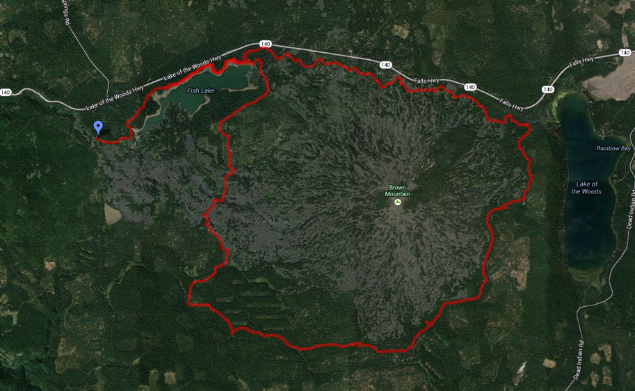
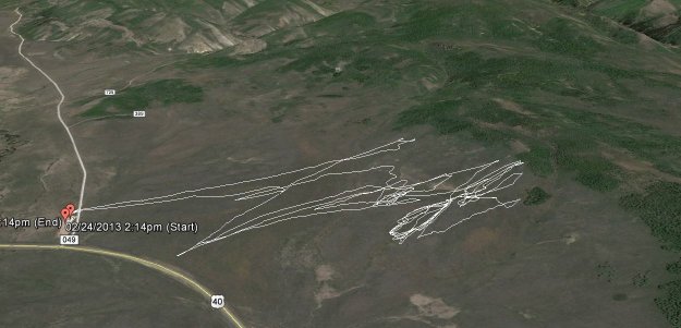
Nice ride Kraemer!! Will definitely try that one, the next time we are in Ashland.
The ride stats, from your map...
Total Distance: 45.70 km (28.4 mi)
Total Time: 3:25:39
Moving Time: 2:55:37
Average Speed: 13.33 km/h (8.3 mi/h)
Average Moving Speed: 15.61 km/h (9.7 mi/h)
Max Speed: 43.20 km/h (26.8 mi/h)
Min Elevation: 1372 m (4500 ft)
Max Elevation: 1710 m (5611 ft)
Elevation Gain: 1269 m (4164 ft)
Max Grade: 23 %
Min Grade: -26 %
Recorded: Wed Jul 23 13:21:52 PDT 2014
_________________
- matt wheeler |
|
|
Kraemer
Since 24 Apr 2006
1736 Posts
Sky Pilot
Unicorn Captain
|
|
|
LapDog
Since 19 Dec 2008
66 Posts
White Salmon
|
| Thu Sep 18, 14 9:58 am |
|
|
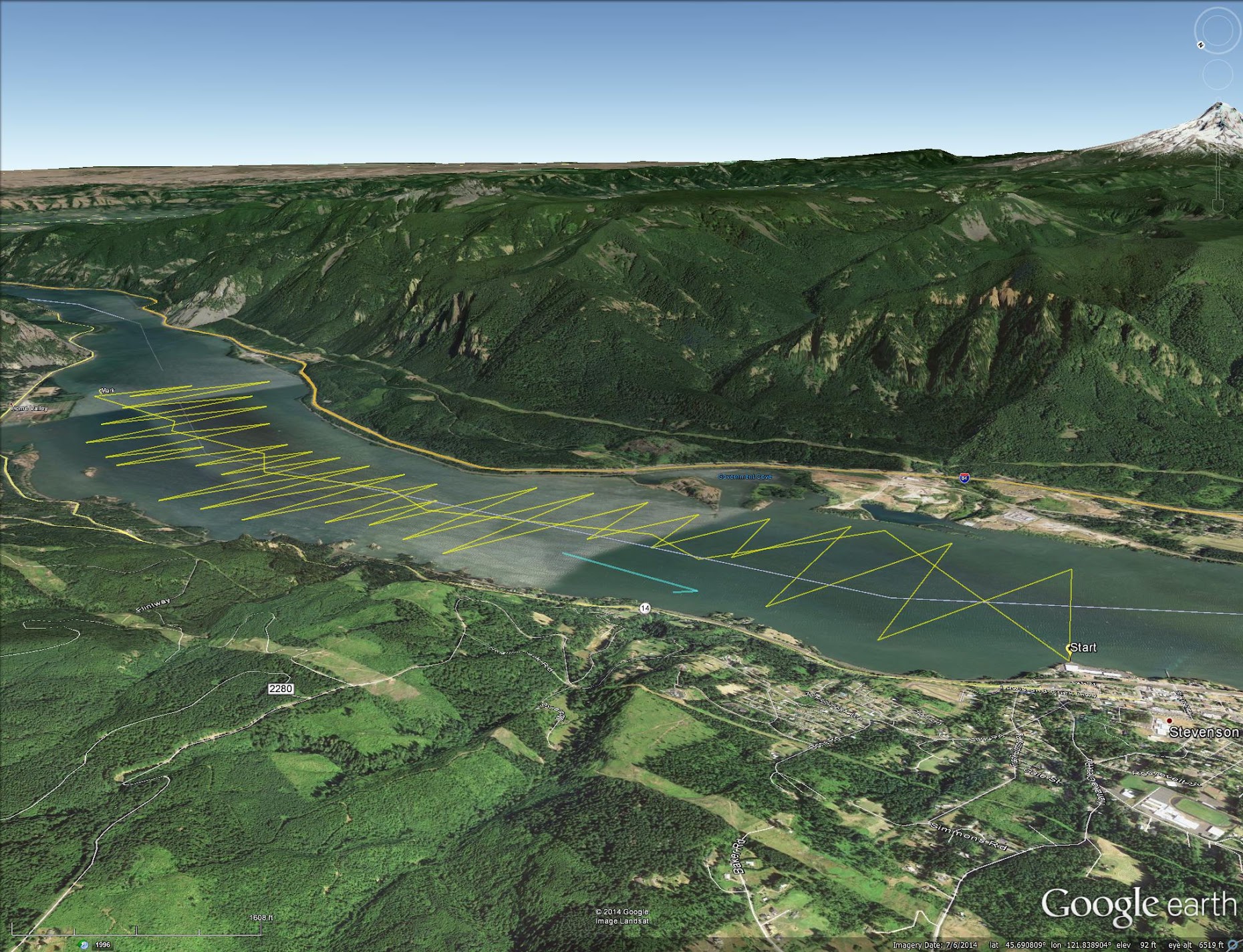
Finally made it from Stevenson to Home Valley and back on east winds (upwind and upcurrent). Have been trying for years. Didn't have my GPS on, but drew my path in Google Earth from memory.
Anyone else tried this "lap"? Care to share your strategy?
_________________
- matt wheeler |
|
|
moondog
Since 15 Aug 2007
706 Posts
white salmon
Addicted
CGKA Member
|
| Sun Sep 21, 14 8:47 pm |
|
|
That is quite an accomplishment on easterlies.............you go bro!
_________________
moondog |
|
|
LapDog
Since 19 Dec 2008
66 Posts
White Salmon
|
| Tue Sep 23, 14 10:53 am |
|
|
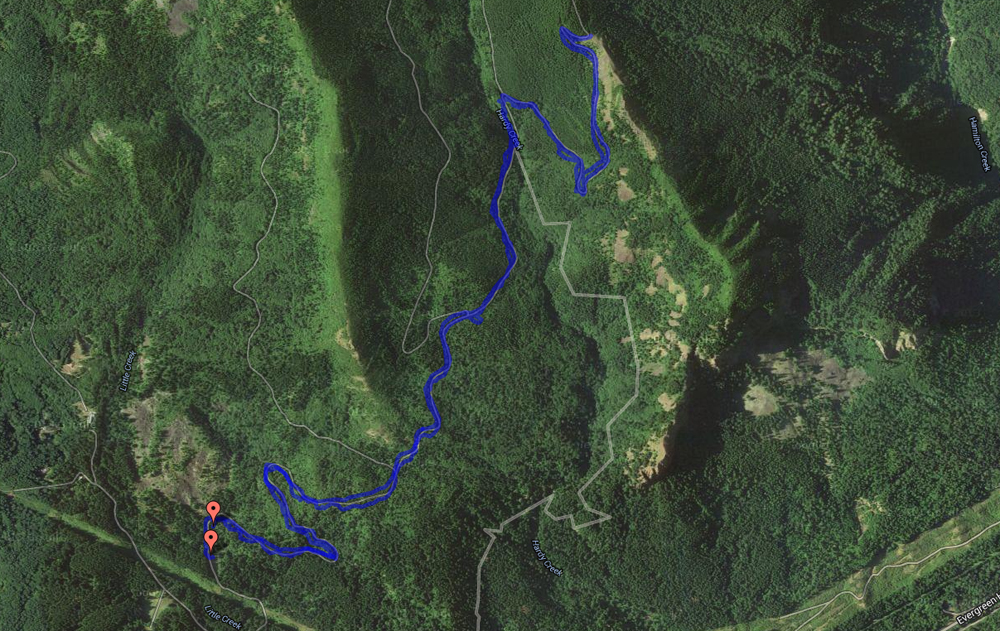
Here is a nice track made on a foilboard by Erin Loscocco. I can't wait to find out what kind of tours are possible on the Columbia with a foilboard!
_________________
- matt wheeler |
|
|
barfly

Since 31 Mar 2005
1216 Posts
Portland
BRACKISH
|
| Wed Sep 24, 14 7:31 am |
|
|
The River, Strawberry Res Utah
 |
| |
thriver.JPG |
|
|
|
LapDog
Since 19 Dec 2008
66 Posts
White Salmon
|
|
|
barfly
Since 31 Mar 2005
1216 Posts
Portland
BRACKISH
|
| Thu Sep 25, 14 11:44 am |
|
|
| LapDog wrote: | | Must be a GPS track of snow kiting at Strawberry Res? |
Yes terra firma. A local told me it was called "The River" which is a few miles West ish from the reservoir. The area reminded me a lot of the Camas.
|
|
|
|