|
previous topic :: next topic |
| Author |
Message |
SpaceRacer
Since 04 Nov 2007
434 Posts
Obsessed
|
 Fri Jul 25, 14 5:46 am Fri Jul 25, 14 5:46 am |
 |
|
| Good topic and good idea but the truth of the matter and the best rule of them is: There are and expect there to be hazards ANYWHERE within 20 yards of ANY shoreline or island line or what have you. The more I kite the Gorge the more I stay the fu@k away from ALL shorelines. When the river is full of white caps you can't see half the markers for gill nets until you are on top of them. Launch and get into the barge lane where it is safe period. And save your showing off for your mom.
|
|
|
sromano1995

Since 22 May 2013
240 Posts
Portland
Stoked
|
| Sat Jul 26, 14 8:42 am Marker 02 - in place |
|
|
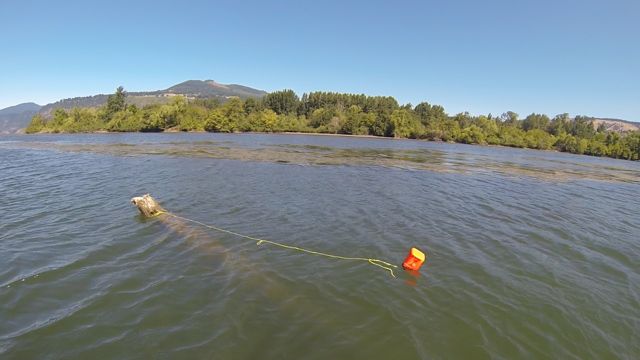
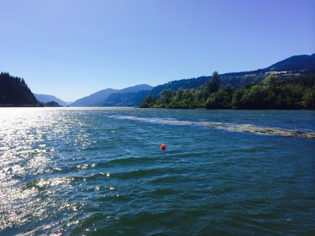
Added marker 02 on the South side of Wells yesterday. Another pretty nasty log for PWC and boats. Visible at low water levels but totally submerged at high water level.
 |
| |
Screen Shot 2014-07-26 at 9.36.54 AM.jpg |
 |
| |
IMG_3595-medium.jpg |
|
|
|
sromano1995
Since 22 May 2013
240 Posts
Portland
Stoked
|
| Sat Jul 26, 14 8:57 am |
|
|
| I like your rule SpeedRacer and I pretty much follow the same rule except that some dangers seem to be way more than 20 yards away from the shoreline. This is especially true and obvious in shallow sections of the river. The two logs I marked are easily 150 yards away from the shoreline and what would appear to be a safe riding / boating area/channel.
|
|
|
SpaceRacer
Since 04 Nov 2007
434 Posts
Obsessed
|
| Sat Jul 26, 14 1:37 pm |
|
|
| Sounds good sromano! Thanks for taking the time and care to do this!
|
|
|
allenlight
Since 19 Jul 2008
44 Posts
|
| Sun Jul 27, 14 7:22 am |
|
|
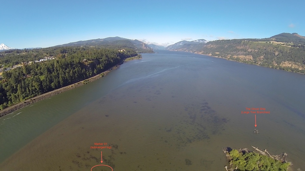
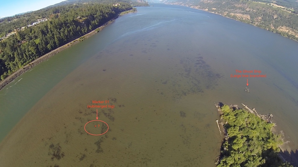
| Good work Sromano. There is another large log / stump to the north and west of item #1 on your map that was marked in the past and should be marked again. It's right in the cruising path between the island and the better wind to the north and west of the island. Also, it tends to be about 4" under the surface..
|
|
|
sromano1995
Since 22 May 2013
240 Posts
Portland
Stoked
|
| Mon Jul 28, 14 4:43 am |
|
|
| Thanks Allenlight. This is great intel and it seems like this is another high risk spot since, based on your description, it is right in the kiting path. Will be looking for it next time I am there.
|
|
|
sromano1995
Since 22 May 2013
240 Posts
Portland
Stoked
|
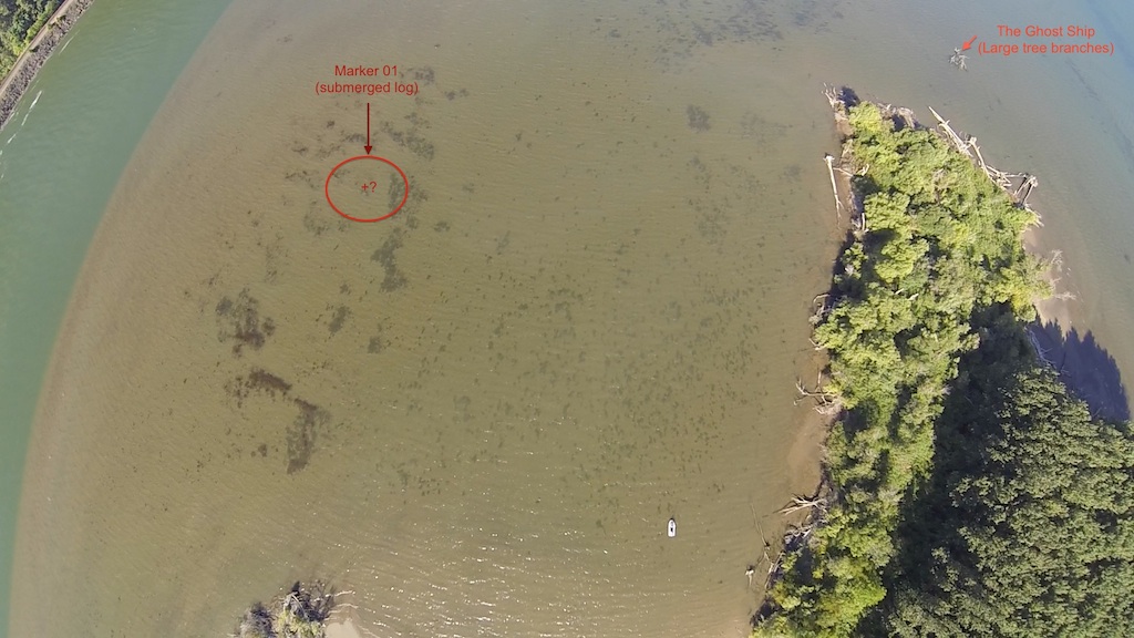
| Mon Jul 28, 14 5:51 am Wells Dangers Aerial View |
|
|
A couple of pics showing the currently "known & located" danger spots West of Wells. If you know and can mark the location of any other danger, please copy and annotate these pics or send me a note. I will try to map / take aerial shots of other areas next time I am there.
 |
| |
Wells Danger Map - 2014-07-28 at 6.09.14 AM .jpg |
 |
| |
Wells Danger Map - 2014-07-28 at 6.09.28 AM copy.jpg |
 |
| |
Wells Danger Map - 2014-07-28 at 6.09.41 AM copy.jpg |
|
|
|
|