|
previous topic :: next topic |
| Author |
Message |
buttersmoothcarver

Since 08 Oct 2008
246 Posts
Stoked
|
 Sat Apr 30, 11 12:11 am Rad snowkiting 45 minutes from Hood River! Sat Apr 30, 11 12:11 am Rad snowkiting 45 minutes from Hood River! |
 |
|
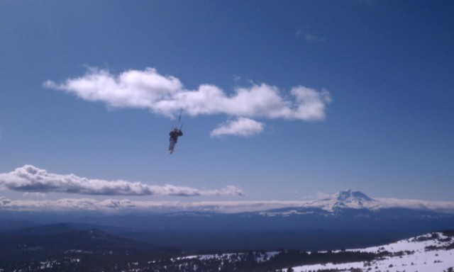
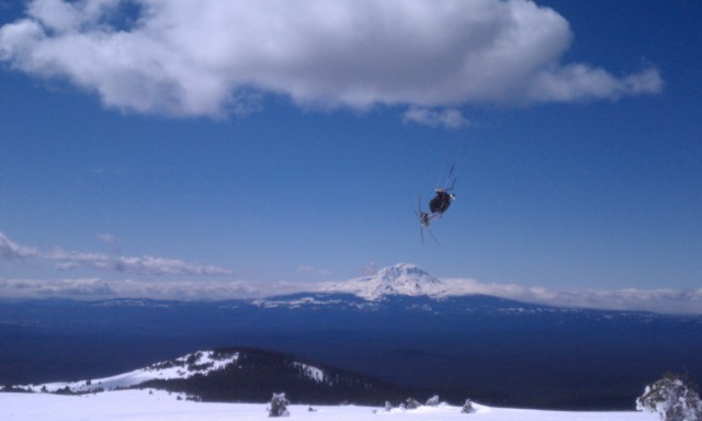
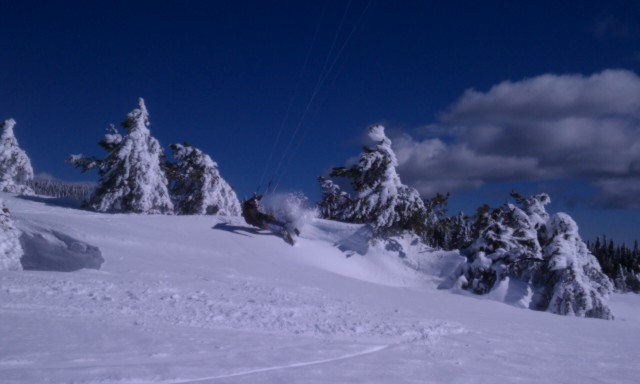
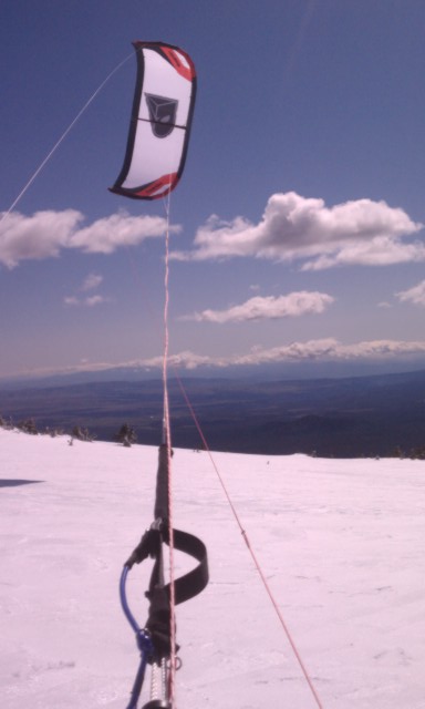
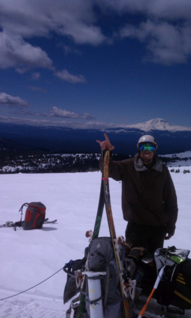
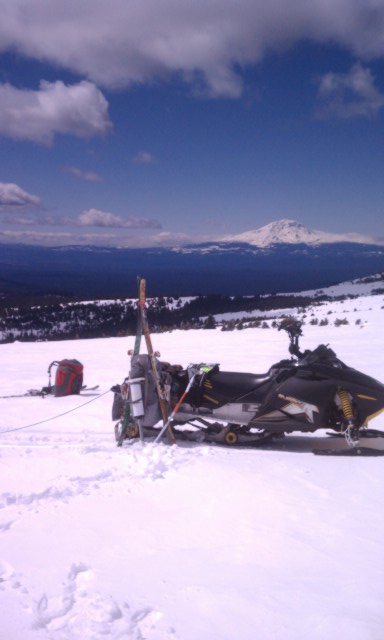
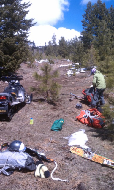
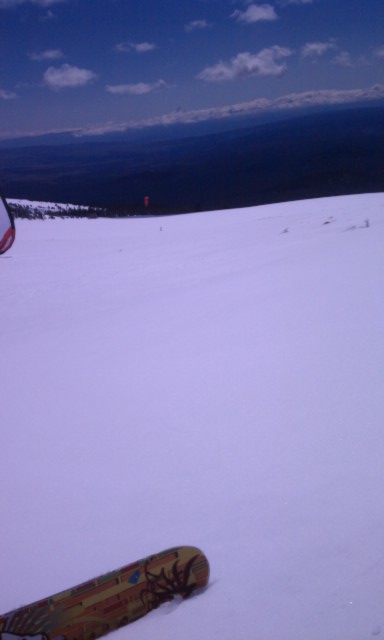
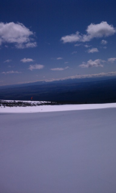
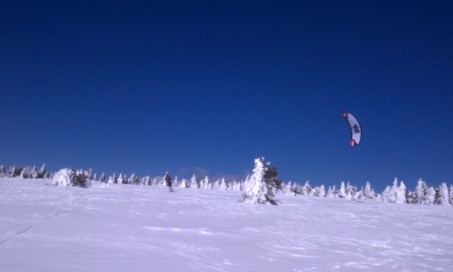
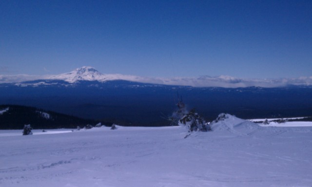
Ok, I know......Just when your completely over this long ass winter, some rockstar will post more dangle pics of another epic snowkite session from UT, WY, MT, ID creating "wish you were there, envy". Unfortunatly, around HR we don't have ideal conditions during Winter months, however there are a few "party spots", and when the weather clears and Spring like conditions kick in. IMO, the snowkiting around here is still so untapped, good, and easily accessible. So grab, your big backpack (so you can carry all your gear) , get on Google earth, and hike/tour/sled in and its all yours until late May/June. FYI, this spot ......Go on strong westerly gradient, check Goldendale for clear skies and double digit flow. Go early enough so you can hit Rufus on the way home, Good Luck!
 |
| |
IMAG0673.jpg |
 |
| |
IMAG0654.jpg |
 |
| |
IMAG0692.jpg |
 |
| |
IMAG0666.jpg |
 |
| |
IMAG0640.jpg |
 |
| |
IMAG0638.jpg |
 |
| |
IMAG0637.jpg |
_________________
Sent from phone, please excuse typos.
Brad Gordon
Thermal Foundation
www.snowkiteadventures.com
text 2063000450 |
|
|
pkh

Since 27 Feb 2005
6549 Posts
Couve / Hood
Honored Founder
|
| Sat Apr 30, 11 6:34 am |
|
|
| Nice find Brad!
|
|
|
luke
Since 06 Jul 2005
399 Posts
Obsessed
|
| Sat Apr 30, 11 6:45 am Indian Rock |
|
|
Yeah Brad. Those shots came out great.
The spot where Brad is riding is called Indian Rock. It is a super sweet spot. A 5 mile long ridge that faces southwest. It can handle wind from any direction but SW to NW is best. It is at 5,000' so it has plenty of snow. Indian Rock is the highest point in Klickitat County. To access it, go north on Monument Drive, which is about 5 miles northwest of Goldendale, WA. When you get to the "Monument", continue north on the dirt road for 3 miles. Take a right on the on the Dead End road. Drive until the snow gets too deep. Hike, skin, or sled from there. It is 2 miles from the right turn to where you kite.
This link gives the hourly wind speed of nearby Grayback Mt. The speeds correlate closely to Indian Rock. ie, yesterday when Brad and I where up there the readings were WNW 18-22.
http://www.wrh.noaa.gov/mesowest/mwmap.php?map=pdt
Today might be a great day for the double. Indian Rock - Rufus. Any one want to hit it?
|
|
|
Gman

Since 11 Feb 2006
4912 Posts
Portland
Unstrapped
|
|
|
buttersmoothcarver
Since 08 Oct 2008
246 Posts
Stoked
|
| Sat Apr 30, 11 8:56 am |
|
|
Few more pics
 |
| |
IMAG0644.jpg |
 |
| |
IMAG0645.jpg |
 |
| |
IMAG0685.jpg |
 |
| |
IMAG0661.jpg |
_________________
Sent from phone, please excuse typos.
Brad Gordon
Thermal Foundation
www.snowkiteadventures.com
text 2063000450 |
|
|
Chooch

Since 18 Nov 2007
1871 Posts
Wicked Pissah
Boston Tea Bagger
|
| Sat Apr 30, 11 9:04 am |
|
|
| 2 Mile hike in sounds worth it for the goods. Way to get after it and thanks for the beta!
|
|
|
jac1313
Since 10 Nov 2007
36 Posts
Gresham
|
| Sat May 21, 11 8:55 pm |
|
|
| So I went exploring today and decided to check out Indian Rock. I must have made a wrong turn somewhere because I never quite made it there. What exactly is the "monument"? The ridge was obscured by clouds so I'm not even sure if there is much snow left. I just started to see some patches of snow at around 4000'.
|
|
|
Nak

Since 19 May 2005
4337 Posts
Camas
Site Lackey
CGKA Member
|
| Sun May 22, 11 1:58 am |
|
|
| Very cool! Thanks for sharing!!!
|
|
|
|